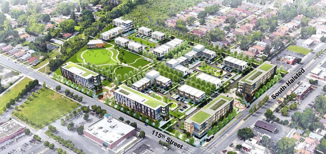
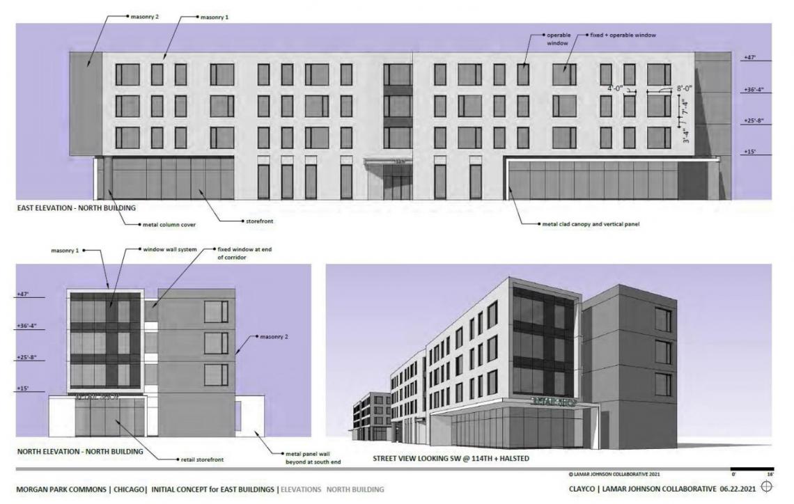
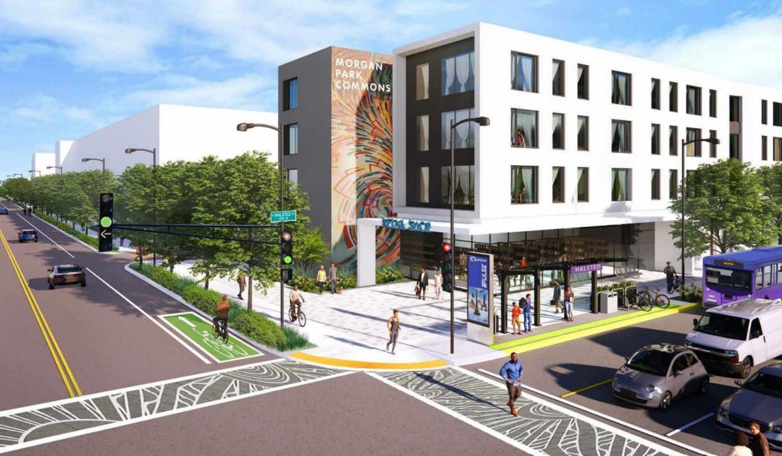
The Committee on Design has reviewed plans for Morgan Park Commons, a proposed mixed-use development located at the northwest corner of W. 115th St and S. Halsted St. Addressed at 11420 S. Halsted, the new multi-phase development would be built on the 12-acre site of a former Jewel-Osco that has been vacant for over 16 years.
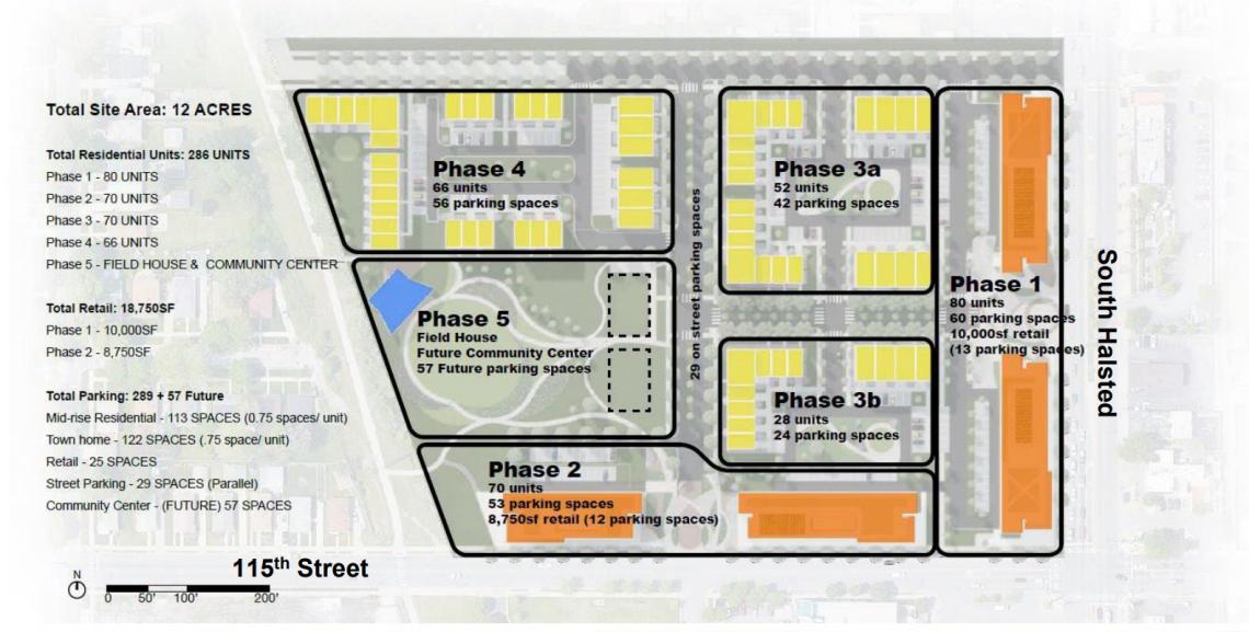
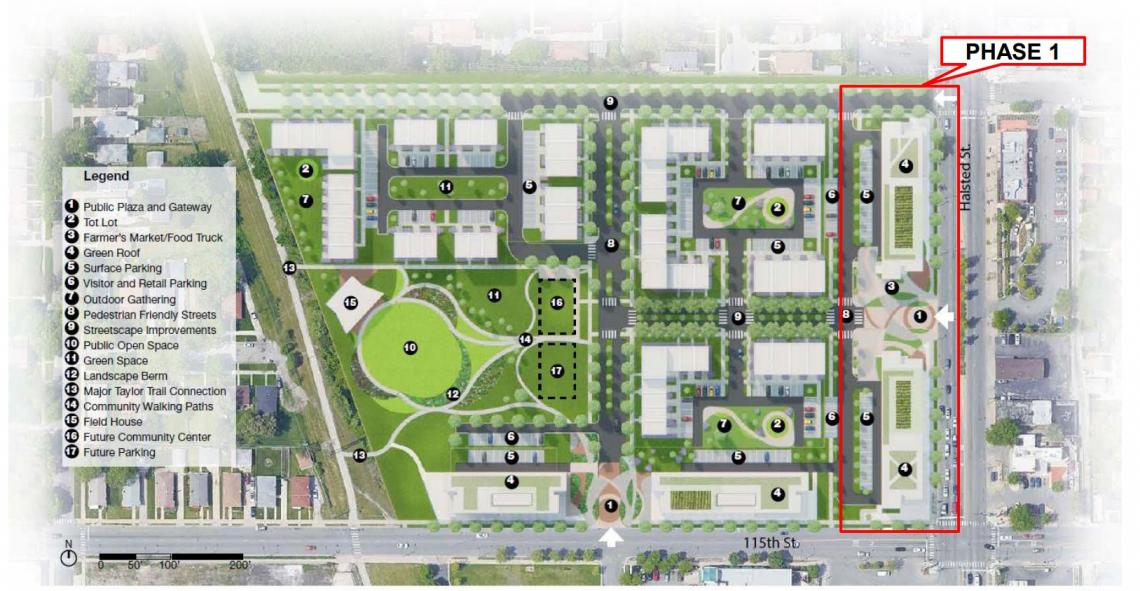
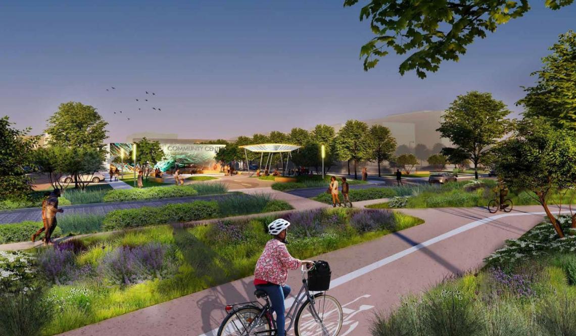
Planned by the Far South Community Development Corporation, the site will be split up into five phases encompassing 150 rental units, 136 townhomes, 18,750 square feet of retail space, and a new 3-acre park with fieldhouse for the neighborhood. Mixed-use apartment buildings will front the main streets of S. Halsted St and W. 115th St in the first two phases, with the third and fourth phases bringing the 136 townhomes. The three-acre park and fieldhouse are planned for the fifth phase, located along the Major Taylor Trail on the west side of the development site.
 Morgan Park CommonsLamar Johnson Collaborative
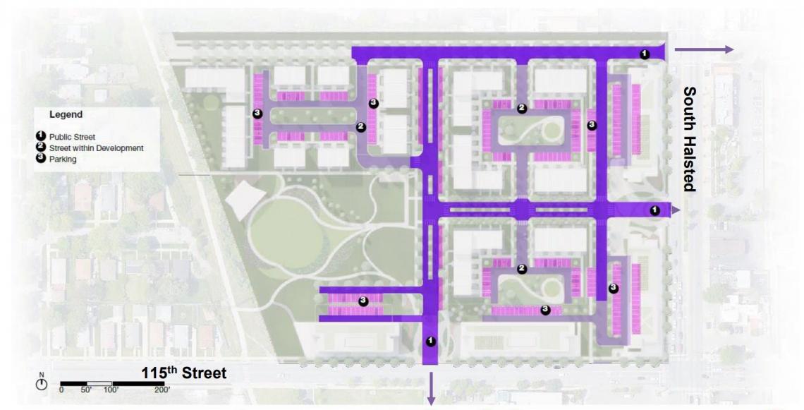
With Lamar Johnson Collaborative on board for the design, the property has been split up with new roadways that will provide access to all of the townhomes and new park inside the large site. Two gateway plazas along S. Halsted St and W. 115th St will celebrate the entry into the development while offering larger spaces for pedestrians over cars. Within the development, streets have been designed as larger boulevards with green medians and more trees and planters.
 Morgan Park CommonsLamar Johnson Collaborative
The discussion opened with Reed Kroloff, who questioned the strong axial street in the center of the site connecting east/west to S. Halsted St when there is already a street along the north boundary of the site. The architects responded that the northern street is being used as a service road, but Kroloff noted that it seems like there are a lot of internal streets and wondered if that center boulevard couldn’t be a great pedestrian avenue instead. The developer chimed in to agree that there could be some level of street elimination, but through the community process they added more parking and street access to appease the alderman and community concerns.
 Morgan Park CommonsLamar Johnson Collaborative
Hana Ishikawa commented next, saying that, in reality, most people will likely use that northern road to access the site. Southbound traffic would take it as the first access point while northbound traffic couldn’t use the access at the gateway plaza due to a median, resulting in a likely left turn into the north access point. Ishikawa also commented on the boulevards, calling them problematic due to their large dimension separating people. Additionally, Ishikawa saw the dead-end driveways as very confusing and could make it very hard to get in and out of the site.
 Morgan Park CommonsLamar Johnson Collaborative
Juan Moreno added his thoughts next, thinking that the boulevard should connect into a grander terminus at the park. Turning his attention to the preliminary concepts for the first phase buildings, Moreno commented that the residential entries are getting lost due to the prominence of the retail spaces. Additionally, Moreno commented that the team should spend more time on the back elevation of the buildings to ensure they don’t feel like the back side as they face the rest of the development.
 Morgan Park CommonsLamar Johnson Collaborative
Brian Lee joined the conversation next, noting that the circulation should be diminishing as you get closer to the buildings, and that boulevards can be very dividing. Lee also questioned whether the park should be completed in Phase 1 rather than Phase 5 to help attract residents to the development with that amenity from the start.
John Ronan was the last committee member to comment, beginning by applauding the initiative of building affordable housing. Ronan questioned why the plan departed abruptly in scale from the surrounding context and neglected to continue the urban grid into the parcel. Ronan commented that the taller height of the perimeter buildings gave a fortress-like reading.
 Morgan Park CommonsLamar Johnson Collaborative
The developer responded that the roadway design was based on the existing access points to the site and went the way of the existing fabric after engaging in conversations with CDOT regarding extending the existing streets into the site. In regard to the change in scale, the developer commented that this housing type was chosen due to the lack of it in the neighborhood and the effort to diversify housing in the neighborhood. Ronan closed off his comments by saying that they need to be careful, because if he described a development with larger buildings along the main corridors and shorter townhomes in between, he could be describing Cabrini-Green. Ronan urged that he doesn’t want new development to be making the same mistakes again.
As the development progresses, Far South CDC will need to amend the existing Planned Development on the site. Indicating future approvals from the Chicago Plan Commission, Committee on Zoning, and City Council. A timeline for the development has not been made public.