The Chicago Plan Commission has adopted the Western Avenue Corridor Study. Developed as a community-based planning initiative, the study looks at land use, development patterns, and circulation along a northern 5-mile stretch of Western Ave. Stretching from W. Addison St to the south up to W. Howard St to the north, the study spans four wards and many neighborhoods.
On the city side of the project, DPD and CDOT co-led the study. The city retained Site Design Group, Skidmore, Owings, and Merrill, Latent Design, Sam Schwartz, and Borderless to help draft and complete the study. With almost two years of community input and discussion, the plan looks to envision a corridor with thriving places, safe and attractive streets, and resilient communities.
 Western Ave Corridor StudyDPD
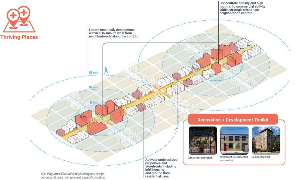
For thriving places, the study looks to concentrate density and high foot traffic in strategic mixed-use neighborhood centers, with lower density housing infill in between those neighborhood centers. With lots of underutilized retail spaces, ground floor housing is envisioned for those lower density buildings in between the high-density nodes. Placemaking efforts are envisioned for the high-density centers, with landscaping, site furniture, public spaces and programming, public art, and branding proposed. Buildings would be setback along narrow sidewalks and a toolkit has been prepared for activating underutilized storefronts.
 Western Ave Corridor StudyDPD
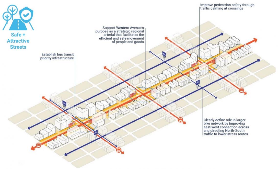
With Western Ave as a strategic, regional arterial street, the plan looks toward creating safe and attractive streets for the corridor. As a more efficient way of moving people, the study would prioritize bus infrastructure including bus lanes, bus bulb-outs, and optimizing signal timing for bus travel and pedestrians. Pedestrian safety would also be improved at intersections as well as bike infrastructure would be integrated with new east/west crossing improvements. North/south bike traffic is intended to be directed off of Western Ave to lower-stress routes.
 Western Ave Corridor StudyDPD
To create resilient communities, the study identifies three main drivers to reach more resilient neighborhoods. The first, environmental, looks towards improvements in air quality, disaster resilience, stormwater, heat island effect, biodiversity, and noise pollution. Economic, the second factor, looks at income equity, employment, business success, neighborhood amenities, storefront and site vacancy, and activation. The final driver, sociocultural, looks at equity, accessibility, mental health, physical health, safety, and community cohesion. All policy changes and redevelopment along Western Ave is charged with supporting these resilient initiatives.
 Western Ave Corridor StudyDPD
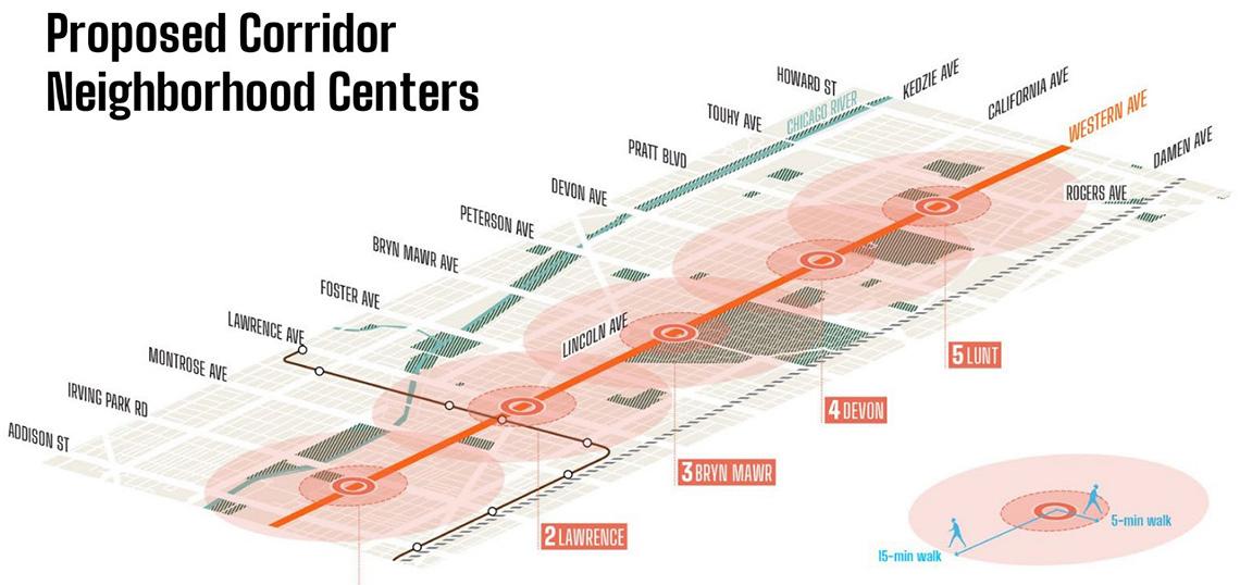
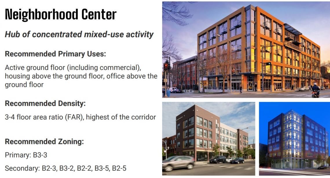
With more detail in the land use framework, the neighborhood center is defined as a mixed-use core with higher density and the clustering of commercial, institutional, transit, and housing. The plan recommends commercial and retail space on the ground floor with residential or offices above. A B3-3 zoning and FAR of 3-4 is suggested for these zones. Five neighborhood centers have been identified as part of the study, which include Irving Park, Lawrence, Bryn Mawr, Devon, and Lunt.
 Western Ave Corridor StudyDPD
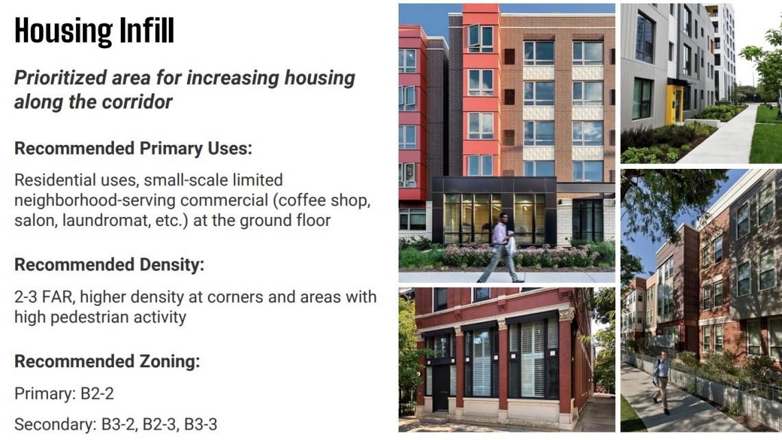
In between the neighborhood centers, the housing infill zones are charged with increasing housing along the corridor. Recommending residential uses with some limited small-scale commercial uses, the plan suggests an FAR of 2-3 and a zoning B2-2. The final zone is the commercial transition zone, which would be predominantly commercial uses with some potential for residential or office above. This lower density model would suggest an FAR of 2-3 and a B3-2 zoning.
 Western Ave Corridor StudyDPD
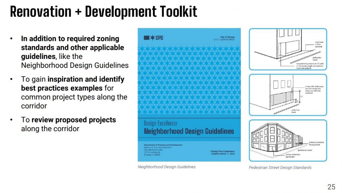
DPD developed a Renovation and Development Toolkit to go along with the study’s materials. To be used in addition to typically required zoning standards, the toolkit supplies inspiration and identifies best practices for the corridor. The toolkit looks to promote renovation and reuse of historic buildings including the conversion of storefronts to housing in the housing infill zones. It also looks to prioritize underutilized sites for new construction.
 Western Ave Corridor StudyDPD
With adoption by the Plan Commission, DPD and its co-contributors will look towards implementation. Next steps include identifying and allocating resources for projects based on study recommendations, as well as piloting innovative policies and projects along the corridor and then evaluating impacts to refine and expand on what works. DPD and aldermen will also look to promote development opportunities to businesses, property owners, and developers while assisting them through the process to align with the study’s vision.